West Branch Louse Creek
| West Branch Louse Creek Biflod till Louse Creek
| |
|---|---|
| Plats | |
| Land | Förenta staterna |
| stat | Nebraska |
| Grevskap | Holt |
| Fysiska egenskaper | |
| Källa | North Branch Vedigre Creek divide |
| • plats | cirka 3 km nordväst om Opportunity, Nebraska |
| • koordinater | |
| • höjd | 1 915 fot (584 m) |
| Mun | Louse Creek |
• plats |
cirka 6 mil väster om Dorsey, Nebraska |
• koordinater |
Koordinater : |
• höjd |
1 706 fot (520 m) |
| Längd | 6,31 mi (10,15 km) |
| Bassängstorlek | 10,14 kvadrat miles (26,3 km 2 ) |
| Ansvarsfrihet | |
| • plats | Louse Creek |
| • genomsnitt | 1,26 cu ft/s (0,036 m 3 /s) vid mynningen med Louse Creek |
| Handfat funktioner | |
| Progression | Louse Creek → Niobrara River → Missouri River → Mississippi River → Mexikanska golfen |
| Flodsystem | Niobrara |
| Broar | 502nd Avenue, 503rd Avenue |
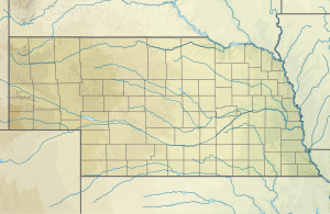
West Branch Louse Creek är en 6,31 mi (10,15 km) lång biflod av andra ordningen till Louse Creek i Holt County, Nebraska . Sammanflödet av denna bäck med East Branch Louse Creek bildar Louse Creek.
West Branch Louse Creek reser sig på North Branch Verdigre Creek- klyftan cirka 2 miles (3,2 km) nordväst om Opportunity, Nebraska i Holt County och flyter sedan mot nordost för att ansluta sig till East Branch Louse Creek och bildar Louse Creek cirka 4 miles (6,4 km) väster om Dorsey , Nebraska .
Vattendelare
West Branch Louse Creek dränerar 10,14 kvadrat miles (26,3 km 2 ) av ytan, får cirka 25,1 tum/år (64 cm/år) nederbörd och är cirka 0,07% skogbevuxen.
Se även

