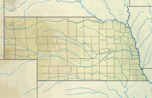
North Branch Verdigre Creek
| North Branch Verdigre Creek Biflod till Verdigre Creek
| |
|---|---|
| Plats | |
| Land | Förenta staterna |
| stat | Nebraska |
| Grevskap |
Knox Holt |
| Fysiska egenskaper | |
| Källa | Elkhorn River klyfta |
| • plats | cirka 4 miles [konvertera] sydost om Opportunity, Nebraska |
| • koordinater | |
| • höjd | 1 880 fot (570 m) |
| Mun | Verdigre Creek |
• plats |
cirka 1 mil sydväst om Verdigre, Nebraska |
• koordinater |
Koordinater : |
• höjd |
1 368 fot (417 m) |
| Längd | 27,96 mi (45,00 km) |
| Bassängstorlek | 111,24 kvadrat miles (288,1 km 2 ) |
| Ansvarsfrihet | |
| • plats | Verdigre Creek |
| • genomsnitt | 12,06 cu ft/s (0,342 m 3 /s) vid mynningen med Verdigre Creek |
| Handfat funktioner | |
| Progression | Verdigre Creek → Niobrara River → Missouri River → Mississippi River → Mexikanska golfen |
| Flodsystem | Niobrara |
| Broar | 878th Road, 570th Avenue, 508th Avenue, 881th Road, 510th Avenue, 512th Avenue, 514th Avenue, 881 Road |
North Branch Verdigre Creek är en 27,96 mi (45,00 km) lång andra ordningens biflod till Verdigre Creek i Knox County, Nebraska .
Kurs
North Branch Verdigre Creek reser sig på Elkhorn River-klyftan cirka 4 miles sydost om Opportunity, Nebraska i Holt County och rinner sedan nordost in i Knox County och sedan öst-sydost för att ansluta till Verdigre Creek cirka 1 mil sydväst om Verdigre, Nebraska .
Vattendelare
North Branch Verdigre Creek dränerar 111,24 kvadrat miles (288,1 km 2 ) av ytan, får cirka 25,3 tum/år av nederbörd, har ett fuktindex på 603,97 och är cirka 4,23% skogbevuxen.
Se även

