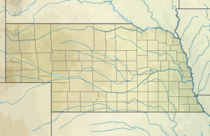
Big Springs Creek (South Branch Verdigre Creek biflod)
| Big Springs Creek Biflod till South Branch Verdigre Creek
| |
|---|---|
| Plats | |
| Land | Förenta staterna |
| stat | Nebraska |
| Grevskap | Antilop |
| Fysiska egenskaper | |
| Källa | Elkhorn River klyfta |
| • plats | cirka 2,5 mil väster om Orchard, Nebraska |
| • koordinater | |
| • höjd | 1 978 fot (603 m) |
| Mun | South Branch Verdigre Creek |
• plats |
cirka 5 miles nordnordost om Orchard, Nebraska |
• koordinater |
Koordinater : |
• höjd |
1 654 fot (504 m) |
| Längd | 10,78 mi (17,35 km) |
| Bassängstorlek | 30,98 kvadrat miles (80,2 km 2 ) |
| Ansvarsfrihet | |
| • plats | South Branch Verdigre Creek |
| • genomsnitt | 3,85 cu ft/s (0,109 m 3 /s) vid mynningen med South Branch Verdigre Creek |
| Handfat funktioner | |
| Progression | South Branch Verdigre Creek → Verdigre Creek → Niobrara River → Missouri River → Mississippi |
| Flodsystem | Niobrara |
| Bifloder | |
| • höger | Hathoway Slough |
| Broar | US 20, 864th Road, 865th Road, 511th Avenue, 866th Road, 512th Avenue, 513th Avenue, 514th Avenue |
Big Springs Creek är en 10,78 mi (17,35 km) lång biflod av tredje ordningen till South Branch Verdigre Creek i Antelope County, Nebraska .
Kurs
Big Springs Creek reser sig på Elkhorn River- klyftan cirka 1,5 miles [CONVERT] väster om Orchard, Nebraska i Antelope County och flyter sedan norrut och nordost för att ansluta sig till South Branch Verdigre Creek cirka 5 miles [CONVERT] nordnordost om Orchard, Nebraska.
Vattendelare
Big Springs Creek dränerar 30,98 kvadrat miles (80,2 km 2 ) av ytan, får cirka 26,1 in/år [OMVÄNDNING] nederbörd, har ett fuktindex på 539,52 och är cirka 2,32 % skogbevuxen.
Se även

