| namn |
Bild |
År byggt |
Plats & koordinater |
Klass av ljus
|
Brännvidd (meter) |
Amiralitet nr. |
NGA nr. |
Område ( nml)
|
Fyren Año Nuevo
|
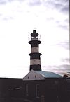 |
1902 |
Río Grande 54°39′17″S 64°8′28″W
|
Fl(3) W 3s |
65,5 |
G1279 |
110-20268 |
21 |
El Rincón ljus 
|
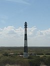 |
1925 |
Villarino 39°23′5″S 62°0′53″W
|
Fl (2+1) W 40s |
64,5 |
G1020 |
110-19580 |
29.1 |
Les Eclaireurs fyr 
|
 |
1920 |
Tierra del Fuego, Antarktis och provinsen Sydatlantiska öarna 54°52′18″S 68°5′0″V
|
Fl W 10s |
22.5 |
G1320 |
111-2620 |
10 |
Fin del Mundo fyr
|
 |
1884 |
Isla de los Estados 54°43′56″S 63°51′25″V
|
Fl(2) W 15s |
70 |
G1283 |
110-20269 |
14 |
Fyren i Cabo Domingo
|
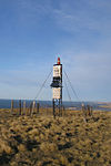 |
1933 |
Río Grande Department 53°40′59″S 67°51′0″W
|
LFl W 8s |
90 |
G1266 |
110-20196 |
7.3 |
Cabo Vírgenes fyr
|
 |
1904 |
Santa Cruz-provinsen 52°20′0″S 68°21′0″V
|
Fl W 5s |
69,5 |
G1260 |
110-20152 |
24 |
Fyren i Cabo Blanco
|
 |
1917 |
Deseado Department 47°12′0″S 65°44′0″W
|
Fl(5) W 40s |
67 |
G1134 |
110-19912 |
13.9 |
Fyren Cabo Guardián
|
|
1928 |
Deseado Department 48°21′24″S 66°21′17″W
|
Fl WR 7,5s |
48 |
G1156 |
110-19952 |
13.7 |
Fyren Querandí
|
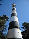 |
1922 |
Villa Gesell 37°27′52″S 57°6′51″W
|
Fl(5) W 26s |
65 |
G0910 |
110-19428 |
18 |
Quequén fyr
|
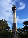 |
1921 |
Quequén 38°34′0″S 58°41′4″W
|
Fl(2) W 15s |
63 |
G0926 |
110-19480 |
25.7 |
Punta Conscriptos fyr
|
|
1929 |
Rawson Department 42°53′0″S 64°42′0″W
|
Fl W 7s |
97 |
G1072 |
110-19684 |
10.5 |
San Antonio fyr
|
 |
1892 |
Cape San Antonio, Argentina , San Clemente del Tuyú , La Costa Partido 36°18′24″S 56°46′24″W
|
Fl W 17s |
63 |
G0904 |
110-19420 |
28 |
Campana fyr
|
 |
1928 |
Deseado Department 48°23′59″S 66°28′15″W
|
Fl(2) WR 16s |
50 |
G1158 |
110-19956 |
11,3, 9,3 |
Fyren Cabo Dañoso
|
 |
1947 |
Magallanes Department 48°49′0″S 67°12′0″W
|
Fl(4) W 45s |
44 |
G1160 |
110-19960 |
10.3 |
Fyren Golfo Nuevo
|
|
1916 |
Chubut-provinsen 42°42′54″S 65°1′15″V
|
|
34,5 |
|
|
|
Azopardo fyr
|
 |
|
Santa Cruz-provinsen 47°55′54″S 65°47′36″V
|
Fl W 7s |
40 |
G1153 |
110-19944 |
5 |
Fyren Cabo San Francisco de Paula
|
|
1917 |
Corpen Aike Department 49°44′0″S 67°43′0″W
|
Fl(2) W 15s |
86 |
G1196 |
110-20016 |
13.7 |
Almirante Brown fyr
|
|
1949 |
Biedma Department 42°13′0″S 64°15′0″W
|
Fl(2) W 16s |
76,5 |
G1049 |
110-19640 |
10.2 |
Beauvoir fyr
|
 |
1980 |
Puerto Deseado 47°45′10″S 65°53′33″W
|
Fl(3) W 10s |
48 |
G1139 |
110-19920 |
19 |
Fyren Buen Tiempo
|
|
1917 |
Güer Aike Department 51°32′0″S 68°57′0″W
|
LFl(4) W 45s |
113 |
G1226 |
110-20072 |
13.7 |
Fyren Cabo Aristizábal
|
|
1917 |
Florentino Ameghino Department 45°12′58″S 66°31′40″W
|
Fl W 5s |
46 |
G1097 |
110-19788 |
10.7 |
Fyren Cabo Curioso
|
|
1922 |
Magallanes Department 49°11′0″S 67°37′0″W
|
LFl(3) W 45s |
92 |
G1162 |
110-19964 |
13.7 |
Fyren i Cabo Peñas
|
|
1916 |
Río Grande Department 53°51′0″S 67°34′0″W
|
Fl(2) W 20s |
42 |
G1274 |
110-20256 |
10.3 |
Fyren i Cabo Raso
|
 |
1925 |
Florentino Ameghino Department 44°20′42″S 65°14′9″W
|
Fl(3) WR 40s |
53 |
G1084 |
110-19744 |
11,1, 6,9 |
Cape San Pablo fyr 
|
|
1945 |
Río Grande Department 54°17′0″S 66°42′0″W
|
Fl(2) W 20s |
136,5 |
G1275 |
110-20260 |
11.2 |
Fyren i Cabo San Pio
|
 |
1909 |
Ushuaia Department 55°3′21″S 66°31′25″W
|
Fl(2) W 16s |
55 |
G1292 |
110-20304 |
9.2 |
Chubut fyr
|
|
1933 |
Rawson Department 43°22′0″S 65°3′0″W
|
Fl W 9s |
36,5 |
G1076 |
110-19728 |
6.5 |
Claromecó fyr
|
|
1922 |
Claromecó 38°51′29″S 60°3′7″W
|
Fl(2+1) W 30s |
70 |
G0942 |
110-19536 |
25,9 |
Coig fyr
|
|
1948 |
Güer Aike Department 50°54′0″S 69°8′0″W
|
LFl(2) W 25s |
78 |
G1222 |
110-20068 |
13.1 |
Punta Guzmán fyr
|
|
1928 |
Deseado Department 47°20′53″S 65°43′17″W
|
Fl(2) W 12s |
33 |
G1136 |
110-19916 |
13.9 |
Isla Leones fyr
|
|
|
Chubut-provinsen 45°3′1″S 65°36′27″V
|
|
|
|
|
|
Isla Pinguino fyr
|
 |
1903 |
Deseado Department 47°54′50″S 65°43′9″W
|
Fl(2) W 16s |
60 |
G1152 |
110-19940 |
12 |
Isla Rasa fyr
|
|
1917 |
Florentino Ameghino Department 45°6′0″S 65°24′0″W
|
Fl W 8s |
23 |
G1092 |
110-19768 |
9.3 |
Le Maire fyr
|
|
1926 |
Ushuaia Department 54°48′0″S 64°43′0″W
|
Fl(3) W 32s |
47 |
G1280 |
110-20272 |
8.9 |
Magallanes fyr
|
|
1976 |
Río Grande Department 52°40′0″S 68°36′0″W
|
Fl(3) W 50s |
53 |
G1260.5 |
110-20156 |
12 |
Mar Chiquita fyr
|
|
1932 |
Mar Chiquita Partido 37°46′0″S 57°27′0″W
|
Fl(2) W 15s |
21 |
G0912 |
110-19430 |
14.7 |
Fyren Martín García
|
 |
1897 |
La Plata Partido 34°11′22″S 58°15′12″W
|
Fl(2) Y 10s |
10 |
G0791 |
110-19292 |
6 |
Miramar fyr
|
 |
1988 |
Miramar 38°17′0″S 57°50′0″W
|
Fl W 5s |
78 |
G0922 |
110-19475 |
12 |
Monte Loayza fyr
|
 |
18 juli 1946 |
Santa Cruz-provinsen 47°4′18″S 66°21′36″V
|
|
|
|
|
|
Morro Nuevo fyr
|
|
1918 |
Chubut-provinsen 42°52′0″S 64°9′0″V
|
Fl W 5s |
118 |
G1058 |
110-19664 |
12.7 |
Punta Bajos fyr
|
|
2001 |
Biedma Department 42°23′0″S 63°37′0″W
|
Fl W 3s |
27 |
G1052 |
110-19656
|
13.5 |
Punta Delgada fyr
|
 |
1904 |
Punta Delgada, Argentina 42°45′59″S 63°38′13″V
|
Fl(2+1) W 25s |
71 |
G1054 |
110-19660 |
28 |
Punta Lobos fyr
|
|
1948 |
Florentino Ameghino Department 42°46′0″S 63°38′0″W
|
Fl(2) W 15s |
145 |
G1080 |
110-19740 |
13.7 |
Punta Medanosa fyr
|
 |
1949 |
Deseado Department 48°6′8″S 65°54′59″W
|
Fl(2) W 11s |
29 |
G1154 |
110-19948 |
10 |
Punta Mogotes fyrar
|
 |
1891 |
Buenos Aires-provinsen , Mar del Plata 38°5′30″S 57°32′42″W
|
Fl W 19s |
55 |
G0913 |
110-19472 |
25 |
Punta Médanos fyr
|
 |
1893 |
La Costa Partido 36°52′59″S 56°40′30″W
|
LFl(5) W 40s |
68 |
G0908 |
110-19424 |
28 |
Punta Ninfas fyr
|
|
1916 |
Rawson Department 42°58′0″S 64°19′0″W
|
Fl(2) W 20s |
90 |
G1074 |
110-19668 |
11 |
Punta Norte fyr
|
|
1917 |
Chubut-provinsen 42°4′32″S 63°46′21″V
|
Fl W 10s |
62,5 |
G1050 |
110-19652 |
14.3 |
Punta Piedras fyr
|
|
1917 |
Buenos Aires-provinsen 35°27′0″S 57°9′0″W
|
Fl W 9s |
42 |
G0900 |
110-19403 |
15.1 |
Recalada a Bahía Blanca Light 
|
 |
1906 |
Monte Hermoso Partido 38°59′27″S 61°15′36″W
|
Fl W 9s |
75 |
G0986 |
110-19540 |
28 |
Punta Hewison fyr
|
 |
|
Tierra del Fuego, Antarktis och provinsen Sydatlantiska öarna |
|
|
|
|
|
Punta Tehuelche fyr
|
|
1949 |
Chubut-provinsen 42°24′0″S 64°18′0″V
|
Fl(2) W 20s |
35 |
G1048.8 |
110-19636 |
10.8 |
Páramo fyr
|
|
1924 |
Río Grande Department 53°9′0″S 68°13′0″W
|
Fl W 7,5s |
22.5 |
G1261 |
110-20160 |
10.3 |
Rio Negro fyr
|
 |
1887 |
Río Negro Province 41°3′28″S 62°50′20″W
|
Fl(2) W 20s |
43,5 |
G1028 |
110-19588 |
16 |
Cabo San Diego fyr
|
|
1934 |
Ushuaia Department 54°48′0″S 65°7′0″W
|
Fl(3) W 32s |
40 |
G1276 |
110-20264 |
13.2 |
San Gonzalo fyr
|
|
1928 |
Ushuaia Department 54°58′0″S 65°58′0″W
|
Fl W 10s |
38 |
G1288 |
110-20300 |
7.2 |
Bahía San Gregorio fyr
|
|
1968 |
Florentino Ameghino Department 45°1′0″S 65°38′0″W
|
Fl W 5,1s |
172 |
G1089.4 |
110-19764 |
13.5 |
Cabo San Jorge fyr
|
 |
1925 |
Florentino Ameghino Department 45°46′44″S 67°22′47″W
|
Fl 4 W 32s |
78 |
G1104 |
110-19792 |
14 |
San José fyren
|
|
1917 |
Florentino Ameghino Department 44°31′0″S 65°17′0″W
|
Fl WR 5s |
84 |
G1086 |
110-19748 |
9.3 |
San Matías fyr
|
 |
1924 |
San Antonio Department 40°49′0″S 64°43′0″W
|
Fl(2) W 11s |
42 |
G1031 |
110-19596 |
12 |
San Sebastian fyr
|
 |
1949 |
Río Grande Department 53°20′0″S 68°9′0″W
|
Fl(3) W 40s |
60 |
G1262 |
110-20192 |
13.6 |
Santa Cruz fyr
|
|
1923 |
Corpen Aike Department 50°9′0″S 68°22′0″W
|
LFl(4) W 60s |
157 |
G1210.1 |
110-20020 |
12.9 |
Segunda Barranca fyr
|
 |
1914 |
Carmen de Patagones 40°46′31″S 62°16′26″V
|
Fl(3) W 22s |
38,5 |
G1024 |
110-19584 |
27.2 |
Tvåhundraårig fyr 
|
 |
2011 |
Sarmiento Park 31°25′41″S 64°10′56″V
|
|
|
|
|
|
Fyren i Buen Suceso
|
|
|
Ushuaia Department 54°48′58″S 65°13′59″W
|
Fl(2) W 16s |
57 |
G1277 |
110-20284 |
9 |
Stella Maris fyr
|
 |
1949 |
Concepción del Uruguay 32°28′29″S 58°12′36″V
|
Fl W 4s |
14 |
|
|
|
Zeballos fyr
|
 |
|
Tierra del Fuego, Antarktis och provinsen Sydatlantiska öarna 54°53′30″S 68°36′24″V
|
Fl W 4s |
12 |
G1329.5 |
111-2570 |
7 |
Fyren i Cabo Corrientes
|
|
|
38°1′4″S 57°31′32″W |
Fl W 10s |
75 |
G0915 |
110-19436 |
10 |
Chica fyr
|
|
|
38°58′2″S 61°53′44″W |
L Fl W 10s |
16 |
G0993 |
110-19552 |
7 |
Davison fyr
|
|
|
54°56′33″S 66°54′14″W |
Fl(2) W 16s |
8 |
G1300 |
111-2710,07 |
6 |
Escarpados fyr
|
|
|
54°49′5″S 68°11′16″W |
Fl W 10s |
59 |
G1323.6 |
111-2616 |
6 |
Isla Martillo fyr
|
|
|
54°54′34″S 67°22′30″W |
Fl W 7s |
8 |
G1308 |
111-2700 |
7 |
Las Grutas fyr
|
|
|
40°47′50″S 65°4′32″W |
Iso W 2s |
71 |
G1045 |
110-19626 |
10 |
Punta Atalaya fyr
|
|
|
35°0′57″S 57°32′7″W |
Fl W 6s |
25 |
G0896 |
110-19316 |
10 |
Punta Colorada fyr
|
|
|
41°41′52″S 65°1′32″W |
L Fl (2) B 10s |
54 |
G1046.3 |
110-19628 |
12 |
Punta Espora fyr
|
|
|
54°55′4″S 54°55′4″W |
Fl W 4s |
16 |
G1311 |
111-2684 |
8 |
Punta Mackinlay fyr
|
|
|
54°54′44″S 67°24′52″W |
Fl R 2s |
9 |
G1310 |
111-2696 |
6 |
Punta Observatorio fyr
|
|
|
54°48′58″S 68°17′58″W |
Fl W 2s |
10 |
G1325 |
111-2580 |
7 |
Punta Quiroga fyr
|
|
|
42°14′16″S 64°28′27″W |
Fl W 10s |
40 |
G1047 |
110-19632 |
11 |
Fyren Río Luján
|
|
|
34°26′57″S 58°30′21″W |
Fl R 5s |
14 |
G0860.2 |
110-19402.8 |
8 |
Buenos Aires fyr
|
 |
1999 |
Puerto Madero 34°37′25″S 58°21′48″V
|
Fl W 3s |
90 |
G0846 |
|
|
Fyren Piedra Diamante
|
|
|
34°25′28″S 57°57′38″W |
Fl(2) W 6s |
18 |
G0789 |
110-19284 |
11 |
Fyren Cámara
|
|
|
Cámara Base 62°14′24″S 58°40′41″W
|
Fl W 10s |
18 |
G1387.6 |
111-2724 |
6 |
Potter Cove fyr
|
|
|
Potter Cove 62°14′3″S 58°39′17″W
|
Fl W 7s |
10 |
G1387.7 |
111-2725 |
3 |
Destacamento fyr
|
 |
|
Orcadas Station 60°44′16″S 44°44′21″W
|
Fl W 3s |
|
G1378.5 |
110-20363.2 |
|


